GIS that makes the overlooked undeniable.
Real maps, real data, real people who needed someone to notice. New ones posted here roughly every week.
Chicagoland's Activity Space Divide
Testing a real 2026 sociology finding at the town level: do adjacent Chicagoland municipalities actually share nearby cafes, libraries, and community spaces, or does each have its own separate world?
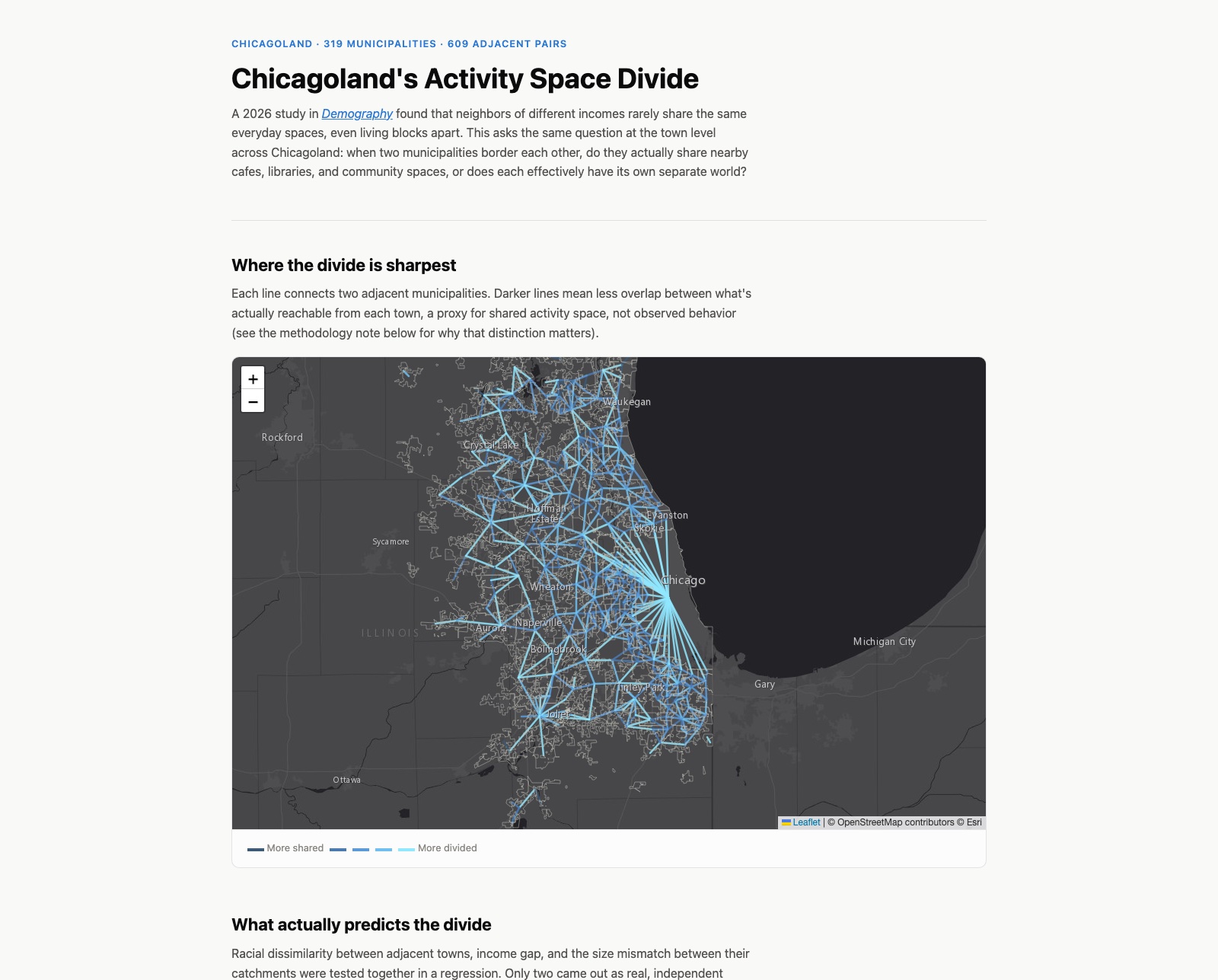
A 2026 study in Demography (Cai, Browning & Anselin) found something counterintuitive: neighbors of different incomes rarely share the same everyday activity spaces, even living blocks apart. I wanted to test the same question at the town level across Chicagoland, using data I could actually get my hands on.
The real question, adapted honestly
The original study tracked individual people's actual movements. I don't have that kind of data, so I built a structural proxy instead: for every pair of adjacent municipalities in the six-county region (609 pairs across 319 towns), I measured how much their nearby "third places" (cafes, libraries, community centers, social facilities) actually overlap, and tested whether that overlap shrinks as the towns' income or racial composition diverges.
What the data actually said
Racial dissimilarity between adjacent towns independently predicts less shared activity space (p = 0.001), even after controlling for income gap and the size mismatch between towns' catchments. Income gap alone showed no independent effect at all (p = 0.846). That's a real divergence from the original study, which centered income specifically, and I think it's more interesting to report honestly than to force a match.
Tinley Park and Matteson are direct neighbors with one of the highest racial dissimilarity scores in the region, but an income gap of just $5,202, about as close to income-equal as adjacent towns get here. Their third-place catchments share zero overlap. If income drove this, these two towns should look demographically alike. They don't.
Being honest about what this isn't
This measures opportunity for shared activity space, what's physically reachable from each town, not observed behavior, which is what the actual mobility study measured. Two towns could share a large catchment on paper and still have residents who never cross into it. I built this as a structural proxy for a real research question, not a claim that I replicated the original finding.
Explore the full network, click any connection for the real numbers.
View the map (opens in a new tab) View the code (opens in a new tab)