GIS that makes the overlooked undeniable.
Real maps, real data, real people who needed someone to notice. New ones posted here roughly every week.
Food Insecurity in DuPage County
My 2023 GIS capstone, and the open-source tool I'm rebuilding from it now.
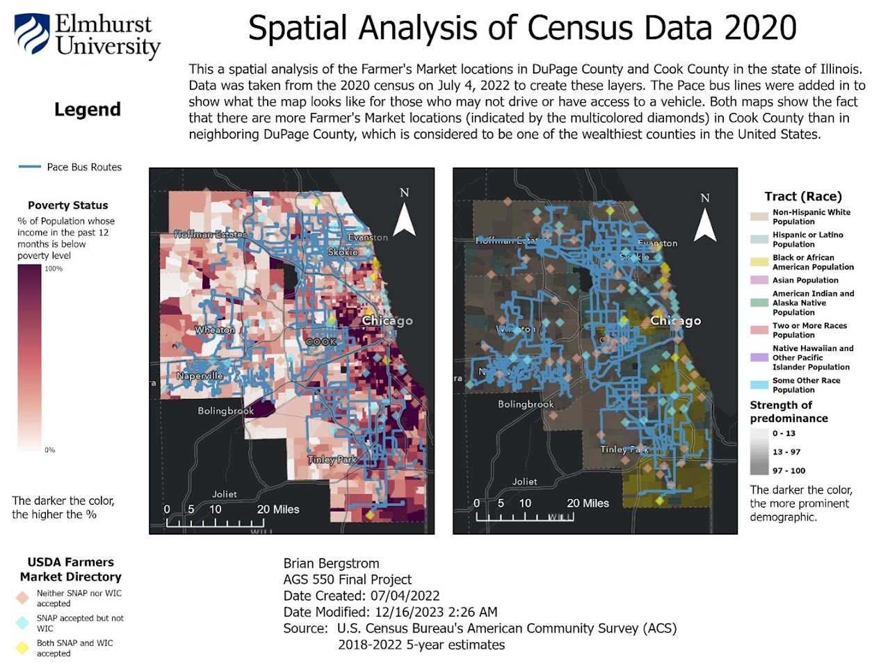
DuPage County is one of the wealthiest counties in the United States — which is exactly why nobody was looking for food insecurity there. For my 2023 MS-GIS capstone at Elmhurst University, I layered 2020 Census data (poverty status, race and ethnicity, internet access) against USDA Farmer's Market and SNAP retailer locations and Pace bus routes, using ArcGIS Online and Arcade to build custom pop-ups showing where bus routes actually intersected with food access.
The numbers were stark: of 523 SNAP-accepting locations in DuPage County, only 166 — 31% — were reachable by bus. Only 10 Pace bus routes remained active in the county as of 2023, after more than half were cut in late 2022.
"I have ridden the bus and train lines for most of my adult life, so I offer a unique perspective."
An honest result, not a clean one
The capstone's own conclusion didn't neatly confirm my starting hypothesis: placing food pantries along bus lines didn't turn out to be the whole fix. Churches were already filling more of that gap organically than I expected going in. I consider that a real finding, not a shortcoming — a hypothesis tested and refined, not confirmed for its own sake.
My professor wasn't impressed, and the food pantries I approached were mostly indifferent. The Northern Illinois Food Bank later built a comparable tool of their own — without the bus-line layer this capstone was built around. I've come to see this less as a weak project and more as one that was ahead of what its immediate audience wanted to hear.
Rebuilding it, open-source
I'm now rebuilding this project's core thesis from scratch — open-source instead of
Esri, and expanded from a single county to a 90-mile radius from Chicago
(il_food_desert and illinois-food-desert-router on
GitHub). It's the recent project I've put the most time into, and it's still in
progress — the data entry is currently manual, which is the main thing standing
between where it is now and a public launch.
The original capstone app is hosted on my university's ArcGIS Online account, which I no longer control — it's still resolving as of this writing, but could go down without warning. The underlying project files are preserved separately.
See the original capstone analysis, or the open-source rebuild in progress.
View the 2023 capstone (opens in a new tab) View the rebuild on GitHub (opens in a new tab)