GIS that makes the overlooked undeniable.
Real maps, real data, real people who needed someone to notice. New ones posted here roughly every week.
Illinois Turning Wood Map
Where 16 prized wood-turning species actually grow across Illinois, based on real USDA Forest Service survey data, not folklore.
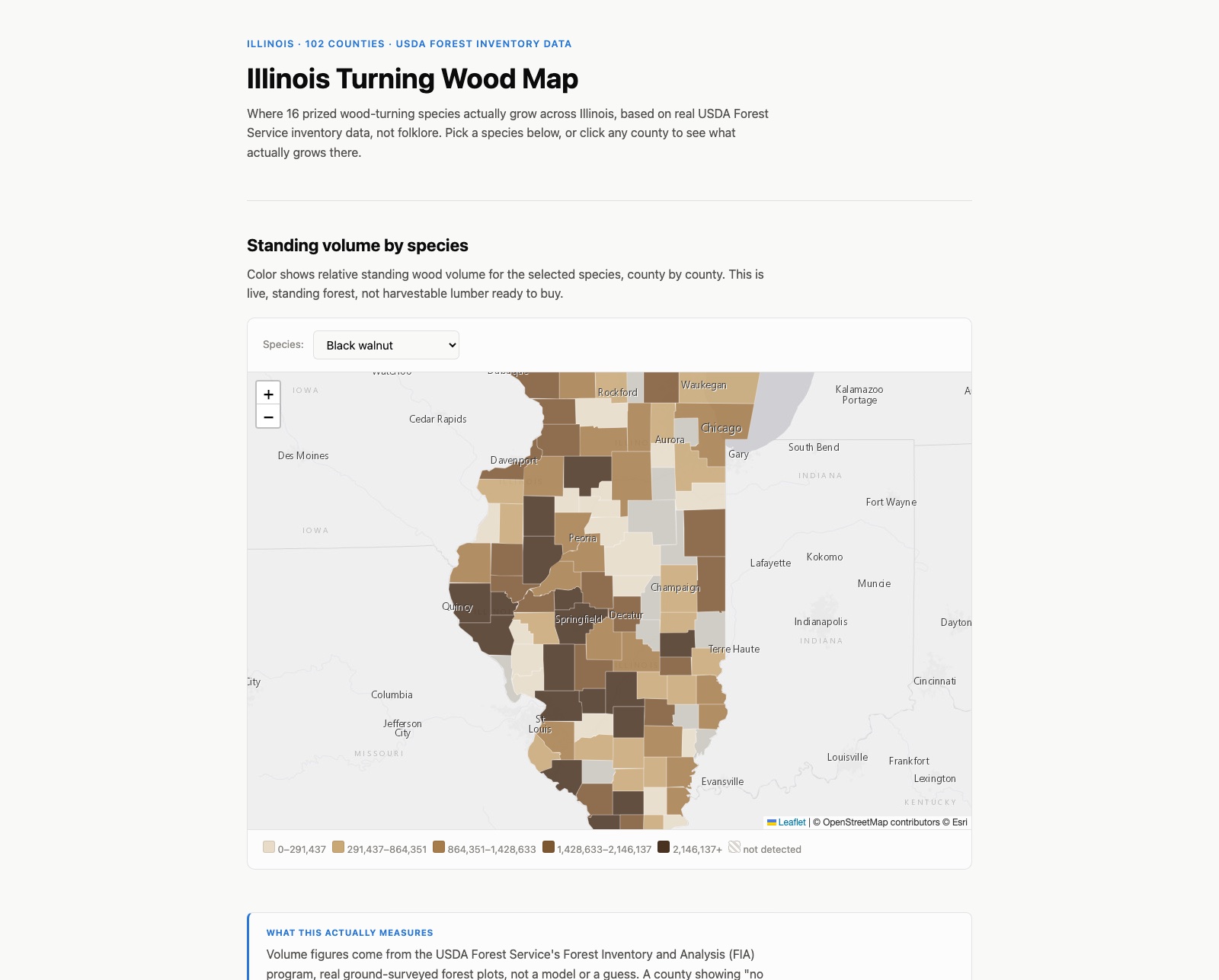
My uncle is a well-known wood turner in the Chicago area. I know almost nothing about wood myself, but I know how to pull real geographic data, so I built this as a surprise for him: a map of where 16 species he'd actually want to work with concentrate across Illinois.
Real forestry data, not a guess
The numbers come from the USDA Forest Service's Forest Inventory and Analysis (FIA) program, the same real, ground-surveyed data foresters and researchers actually use. I pulled standing wood volume by species for all 102 Illinois counties through their public API, then narrowed the full 100-species list down to 16 that turners specifically prize: black walnut, Osage-orange, black cherry, figured maples, oaks, hickory, and more.
A map that changes color with the wood
Each species gets its own color palette loosely based on its actual wood tone, Osage-orange in warm gold, black cherry in reddish brown, common persimmon in near-black. It is a small touch, but it makes switching species feel like looking at a different wood each time, not just a different blue map.
FIA samples forest land on a grid of survey plots, it does not count every tree in the state. A county showing "not detected" for a species means it was not picked up in that county's sample, not necessarily that none exists there. This is standing forest volume, not lumber sitting ready to buy.
Pick a species, or click any county for its real top-5 species ranking.
View the map (opens in a new tab) View the code (opens in a new tab)